Scientists Measure Impacts of Fire and Other Disturbances
on North American Boreal Forest Biomass

Academic researchers measured biomass changes in vast stretches of North American boreal forests like this one in the Watson River Upper Canyon, Carcross, Southern Lakes Region, Yukon, Canada. Photograph by Jakub Fryš, CC BY-SA 4.0, via Wikimedia Commons.
Leveraging NASA Center for Climate Simulation (NCCS) and Boston University (BU) high-performance computing resources, academic researchers analyzed 31 years of satellite data to measure how disturbances including fire and timber harvests have impacted the aboveground biomass (AGB) in North American boreal forests.
Undertaken for NASA’s Arctic-Boreal Vulnerability Experiment (ABoVE), the study covered an area stretching 2.82 million square kilometers (1.09 million square miles) across western Canada and Alaska (see map below).

This map shows timber harvest and fire disturbances occurring within the study domain. Areas outside of harvest (prior to 1985) and fire (prior to 1940) have an unknown disturbance history (“Not Disturbed or Other Disturbance”). Reprinted by permission from Springer Nature Customer Service Centre GmbH: Nature, Nature Climate Change, Disturbance Suppresses the Aboveground Carbon Sink in North American Boreal Forests, Wang et al., 2021.
“Previous studies have observed widespread ‘greening’ of Arctic-boreal ecosystems,” explained Jonathan Wang, Postdoctoral Scholar, Department of Earth System Science, University of California, Irvine, who initially led the study while a doctoral student at BU. “However, frequent and extensive disturbances, such as fires, threaten carbon stocks and can mask actual carbon gains.”

Jonathan Wang, University of California, Irvine, stands atop the Hemlock Walk-Up Tower overlooking Harvard Forest in Petersham, Massachusetts. Flux towers like this one measure water, energy, and carbon exchange between the forest and the atmosphere.
The new study recently appeared in the journal Nature Climate Change. For this research, Wang and his collaborators analyzed 475 billion observations from NASA and U.S. Geological Survey satellites:
| Satellite/Instrument | Instrument Resolution | Years of Coverage |
|---|---|---|
| ICESat Geoscience Laser Altimeter System (GLAS) |
70 meters (m) | 2003–2009 |
| Landsat 5 Thematic Mapper (TM) |
30 m | 1984–2013 |
| Landsat 7 Enhanced Thematic Mapper Plus (ETM+) |
30 m | 1999–2014 |
Observation data sources included ABoVE’s 186-terabyte Landsat dataset in the NCCS Centralized Storage System. The scientists ran time series analysis algorithms on the data using over 500 computing cores of the NCCS Discover supercomputer and ADAPT Science Cloud, an effort that took several months. Further processing resulted in 70 terabytes of intermediate data products that served as inputs to machine learning algorithms run at BU to yield annual 30-meter-resolution AGB estimates, with a final dataset of about 140 gigabytes.
“There is an overwhelming amount of new satellite data becoming available, allowing us to monitor ecosystems with unprecedented detail and nuance,” Wang said. “I considered how long it would take for me to perform this analysis on my desktop computer, and it was on the order of a couple centuries. Supercomputing resources like the NCCS are enabling a real leap forward in our capacity to ingest and analyze remote sensing data.”
Impact: Despite the apparent “greening” of the north, increasing disturbances like fire have suppressed a large amount of recent net biomass growth, resulting in a significant reduction in the carbon sink of the northern high latitudes. Earth system models fail to capture these dynamics, most likely due to their inability to realistically simulate northern fire regimes.
The study team found that over the years 1984–2014 the ABoVE region gained 434 teragrams (478.4 million tons) of AGB. Yet, the prevalence of large fires significantly reduced these gains, which would have been closer to 600 teragrams (661.39 million tons) of AGB. Timber harvests led to additional, although more modest, AGB losses. Wang noted that when considering other ecosystem processes such as fire soil dynamics, it is possible that these Arctic-boreal ecosystems stored nearly zero net carbon.

The maps display the spatial distribution of predicted aboveground biomass (AGB) across North American boreal forests: a. AGB averaged over the study period (1984–2014). b. Net change in AGB from 1984 to 2014. Figure from Wang et al., 2021. Values are in megagrams per hectare (Mg ha-1). Reprinted by permission from Springer Nature Customer Service Centre GmbH: Nature, Nature Climate Change, Disturbance Suppresses the Aboveground Carbon Sink in North American Boreal Forests, Wang et al., 2021.
The researchers also compared their results with those of 27 Earth system models run for the international Coupled Model Intercomparison Project Phase 6 (CMIP6) experiment. Their study showed that on average the CMIP6 models overestimated AGB gains by a factor of three.
“A major reason for this discrepancy was the models’ inability to capture the trends and magnitude in burned areas,” Wang said. “Climate modeling efforts must focus on more accurately capturing fire regimes in order to better understand the near-term evolution of the carbon cycle and — by extension — global climate.”
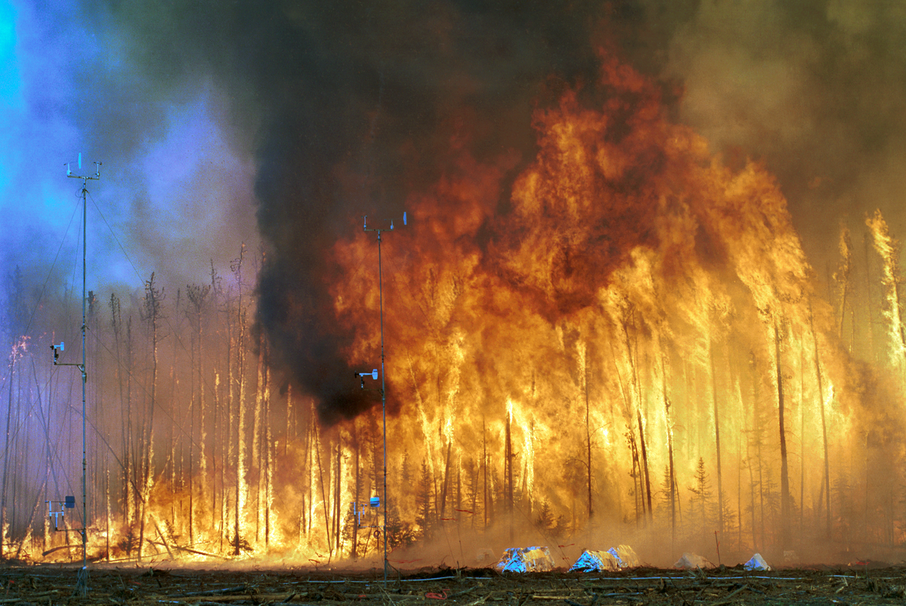
Controlled burns, such as the Northwest Crown Fire Experiment in the Northwest Territories, Canada, show how fire behaves under certain conditions and can guide climate modelers in taking better account of fire dynamics. Photograph used by permission of the USDA Forest Service, CC BY 2.5, via Wikimedia Commons.
Related Links
- Wang, J.A., A. Baccini, M. Farina, J.T. Randerson, and M.A. Friedl, 2021: Disturbance Suppresses the Aboveground Carbon Sink in North American Boreal Forests. Nature Climate Change, 11, 435–441, doi:10.1038/s41558-021-01027-4.
- ABoVE: Annual Aboveground Biomass for Boreal Forests of ABoVE Core Domain, 1984–2014, Oak Ridge National Laboratory Distributed Active Archive Center (ORNL DAAC) for Biogeochemical Dynamics, doi:10.3334/ORNLDAAC/1808.
Jarrett Cohen, NASA Goddard Space Flight Center