Scientists Simulate the Electrical Dynamics of
Thundersnow at NCCS
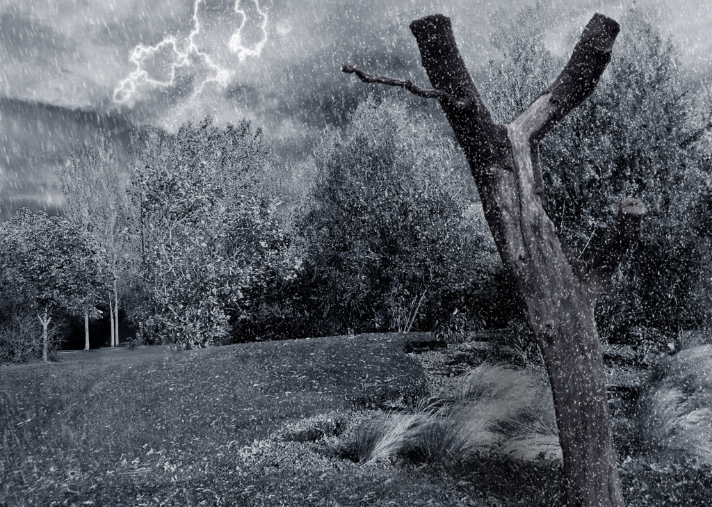
One of the more dramatic and relatively rare weather phenomena is thundersnow, snowfall accompanied by lightning. A recent computational study run at the NASA Center for Climate Simulation explores the details of how thundersnow works. Photo by Sua23tfn, CC BY-NC 2.0, via Flickr.
In a first-of-a-kind study, NASA, university, and industry scientists simulated the electrical dynamics of thundersnow — lightning within snowfall — at the NASA Center for Climate Simulation (NCCS).
“I wanted to undertake this study because no one was able to successfully simulate thundersnow with the electrification parameterization that we used,” said lead author Sebastian Harkema, Research Associate at the University of Alabama in Huntsville (UAH) and NASA Marshall Space Flight Center. “Additionally, a lot of previous observation studies have demonstrated that thundersnow is spatially offset from the heaviest surface snowfall rates, and a numerical simulation would provide a lot of insight into why this is happening.”

Sebastian Harkema was lead author on
the thundersnow simulation study.
Harkema's study collaborators were from UAH, NASA Marshall, NASA Goddard Space Flight Center, the National Oceanic and Atmospheric Administration's (NOAA's) National Severe Storms Laboratory, and BP Exploration and Operating Company, Ltd. The published study appears in the Journal of Geophysical Research: Atmospheres.
“Thundersnow is much more common than what we have historically thought but is still relatively rare compared to lightning flashes in thunderstorms,” Harkema said. “Based on what’s available in literature, thundersnow is common in the eastern Great Lakes region of the United States as well as in Japan. This is a result of similar processes of cold air moving over warm bodies of water, making the environment unstable and increasing the chances of thundersnow.”
To simulate the complex processes involved in thundersnow, Harkema and collaborators employed the NASA-Unified Weather Research and Forecasting (NU-WRF) model with the addition of an electrification/lightning parameterization (approximation) package. Among other things, the ELEC package represents the non-inductive charging mechanism that produces lightning. “Several studies have used this parameterization to examine the electrification processes in a variety of weather, for example, squall lines and hurricanes,” Harkema noted. “However, simulating electrification within winter weather has proven a challenge for WRF-ELEC and NU-WRF-ELC. As far as we are aware, this study was the first one to successfully use WRF-ELEC or NU-WRF-ELEC to simulate thundersnow.”
For the study, the team ran the NU-WRF-ELEC model with nested domains of 9-, 3-, and 1-kilometer (km) grid resolution to simulate a 10–12 April 2019 U.S. Great Plains winter storm and its in-cloud electrification processes in fine detail.
The chosen storm was an ideal case to simulate. Throughout the storm, snowfall rates exceeded 2.54 centimeters (cm), or 1 inch, per hour. Over three days the heavy snowfall resulted in accumulations of more than 60 cm, or roughly 2 feet, in some areas (see map below). The storm was also highly active with lightning. NOAA’s Geostationary Operational Environmental Satellite-16 (GOES-16) Geostationary Lightning Mapper (GLM) observed nearly 20,000 thundersnow flashes.
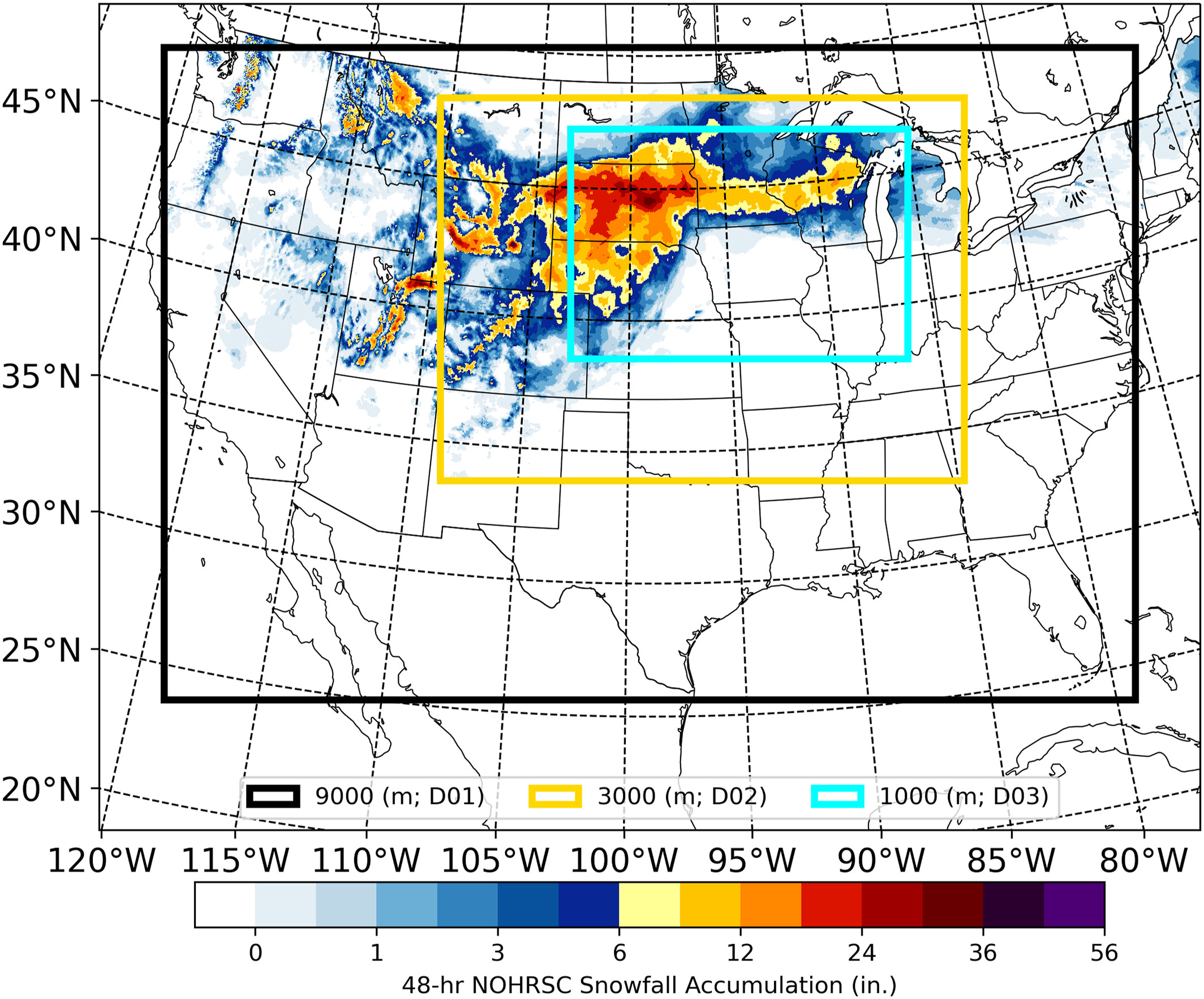
The map shows the NU-WRF-ELEC model spatial domains for the three grid resolutions (black, yellow, and light blue rectangles) and 48-hour National Operational Hydrologic Remote Sensing Center snowfall accumulation in inches (land surface coloring) ending at 00 UTC on 12 April 2019. Figure from Harkema et al., 2024.
To create the most realistic starting conditions for the thundersnow storm simulation, Harkema downloaded High-Resolution Rapid Refresh (HRRR) data from Amazon Web Services (AWS). Initialized with HRRR data, the NU-WRF-ELEC simulation ran on more than 560 processor cores of the NCCS Discover supercomputer during most of the 2 weeks it took to run. The simulation yielded about 4.5 terabytes of data, stored on Discover’s online disk.
“Without access to NCCS supercomputing resources, this study likely would not have been possible, and I would have never been able to complete my Ph.D. in an orderly fashion,” Harkema said. “The compatibility of the Discover supercomputer and NASA numerical weather prediction models made the process of compiling and running the numerical model easy.”
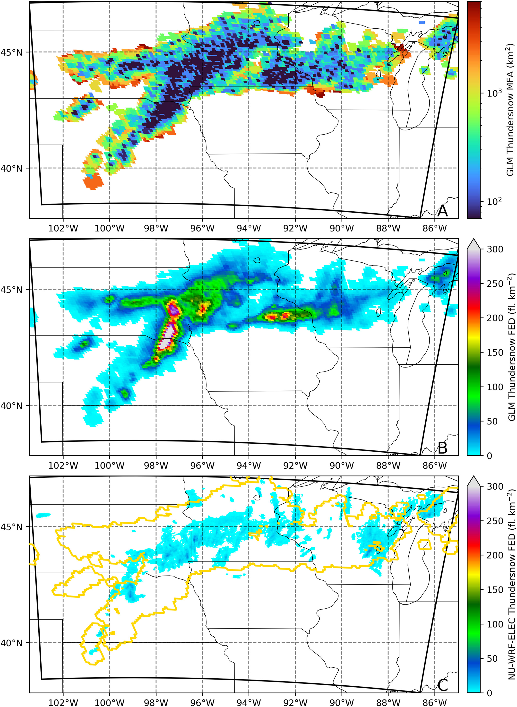
(A) minimum flash area and accumulated flash extent density (FED) between 00 UTC 10 April 2019 and 06 UTC 12 April 2019 for (B) thundersnow flashes observed by the GOES-16 Geostationary Lightning Mapper (GLM) and for (C) simulated thundersnow flashes. The gold contour represents the spatial extent of the GLM gridded observations of thundersnow. Figure from Harkema et al., 2024.
The NCCS-hosted NU-WRF-ELEC simulation produced fewer (1,733) thundersnow flashes than GLM observations (~20,000) yet surprisingly provided a basis for why thundersnow occurs away from the heaviest snowfall as found by other studies: vertical air circulation transports positively charged ice/snow hydrometeors towards the surface and prevents thundersnow from initiating in the heaviest snowfall.
“What surprised us the most about the results was that the simulation provides a basis for the conceptual model of why thundersnow occurs away from the heaviest snowfall rates,” Harkema explained. “Plain and simple, we were not expecting that at all.”
“Additionally, the simulation also provides some evidence that a different form of electrification process may be playing a small role in charge generation within these winter storms and is known as non-inductive charging mechanism within non-riming environments,” he said. “This mechanism is similar to the non-inductive charging mechanism, but the key difference is that the non-riming indicates that supercooled liquid water does not exist in the environment.”
Impact: The study explains why thundersnow is spatially separated from the heaviest snowfall rates within large-scale snowbands and builds on results from the recent NASA IMPACTS field campaign, suggesting that electrification without supercooled liquid water may play a role in weak charge generation in wintertime stratiform regions.
While not having specific plans to continue thundersnow studies, “I will be looking to NCCS resources if I ever need access to high-end supercomputing to run high-resolution numerical models,” Harkema said.
Funding for this research came from the NASA Science Mission Directorate’s Future Investigators in NASA Earth and Space Science and Technology (FINESST) Program.

The movie shows (A) Multi-Radar Multi-Sensor composite reflectivity and Geostationary Lightning Mapper gridded flash extent density observations, (B) NU-WRF-ELEC model composite reflectivity and lightning flash extent densities, and (C) NU-WRF-ELEC model maximum electrical electric fields in the vertical and lightning flash extent densities. Movie adapted from supplement to Harkema et al., 2024.
RELATED LINK
- Harkema, S.S., E.R. Mansell, A.O. Fierro, L.D. Carey, C.J. Schultz, T. Matsui, and E.B. Berndt, 2024: Explicitly Resolving Lightning and Electrification Processes from the 10–12 April 2019 Thundersnow Outbreak. Journal of Geophysical Research: Atmospheres, 129, e2023JD039987, doi:10.1029/2023JD039987.
Jarrett Cohen, NASA Goddard Space Flight Center
March 19, 2025