Field Campaigns on Two Coasts Benefit from GMAO and NCCS Forecast Support
Spring 2019 field campaigns on North America’s West and Gulf Coasts benefited from substantial forecast support by NASA Goddard Space Flight Center’s Global Modeling and Assimilation Office (GMAO) and NASA Center for Climate Simulation (NCCS).
Field campaigns mounted by NASA and its partners involve collecting observational measurements of specific locations on Earth for pre-defined time periods using a variety of non-satellite platforms. Crucial to planning these field measurements, GMAO forecast products during the spring campaigns included customized meteorological and chemistry imagery available via the GMAO FLUID visualization website, hosted on the NCCS DataPortal.

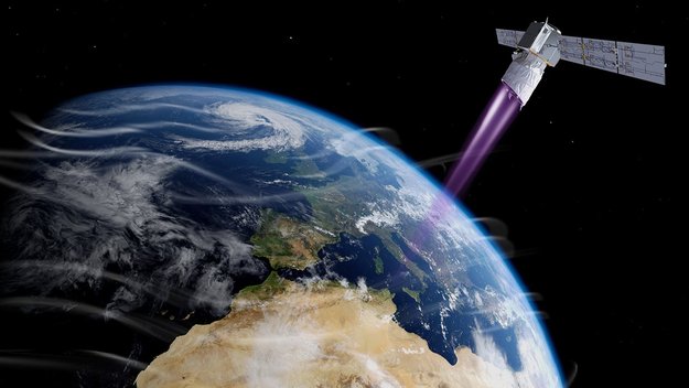
NASA flew its updated Doppler Aerosol Wind Lidar (DAWN) instrument aboard a DC-8 to test its capabilities and validate measurements from the European Space Agency (ESA) Aeolus satellite. Photo by NASA/Lauren Hughes. Illustration by ESA.
In one such field campaign, NASA Langley Research Center conducted airborne lidar experiments during April 15–30, 2019. Their two main goals were to test an updated NASA instrument and to validate measurements from the European Space Agency’s new Aeolus satellite—the first mission to capture global profiles of Earth’s winds. Near-real-time observations from Aeolus will soon be available to weather forecasters worldwide and are expected to improve computer forecast accuracy.
NASA’s DC-8 flying laboratory hosted NASA Langley’s improved Doppler Aerosol Wind Lidar (DAWN) instrument in flights timed to coincide with Aeolus’s passes over the eastern Pacific. The flights from NASA Armstrong Flight Research Center also helped NASA prepare for its contributions to an international Aeolus field calibration/validation campaign in 2020.
For DC-8 flight planning, the GMAO provided forecast products for multi-level analysis including conventional weather maps, 2D chemistry, and 3D chemistry. They displayed these data on customized maps centering on the northeastern Pacific Ocean off the U.S. and Mexican coast.

The Goddard Earth Observing System Forward-Processing (GEOS FP) model produced this forecast of total precipitable water over the northeastern Pacific Ocean.
The Aeolus campaign forecasts were part of the GMAO Goddard Earth Observing System Forward-Processing (GEOS FP) runs, which harness the power of up to 8,400 cores on the NCCS Discover supercomputer.
GEOS FP currently uses 12-kilometer (km) global resolution. Its forecasts are generated four times a day: at 00Z, 06Z, 12Z, and 18Z. The 06Z and 18Z forecasts go out 30 hours, the 12Z forecasts go out 5 days, and the 00Z forecasts go out 10 days. Forecast runtimes are 4:20 for the 00Z forecast, 3:05 for the 12Z forecast, and 2:15 for the 06Z and 18Z forecasts. Products are provided automatically with each updated forecast.
The FP system produces 4 terabytes (TB) of data per day that go into NCCS storage. About 1.1 TB per day are stored on Discover’s online disk and exported to the DataPortal for user access.
“Running a global 12-km data assimilation system like GEOS FP requires a large supercomputer and could not be done in real-time to support mission teams without an installation such as NCCS,” said Rob Lucchesi, GMAO scientific programmer.

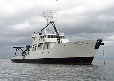
The Satellite Coastal and Oceanic Atmospheric Pollution Experiment (SCOAPE) included a research cruise in the Gulf of Mexico aboard the R/V Point Sur ship.
Another spring campaign was the Satellite Coastal and Oceanic Atmospheric Pollution Experiment (SCOAPE), which took place May 8–19, 2019. SCOAPE was a collaboration between NASA and the Department of Interior’s Bureau of Ocean Energy Management aimed at assessing the feasibility of monitoring offshore air quality with satellite observations. It featured a ship-based research campaign in the Gulf of Mexico, where instruments observed pollutant gradients in regions surrounding three ocean oil platforms for validation of satellite observations and model evaluation.
SCOAPE forecast products came from both GEOS FP and—for the first time during a field campaign—the GEOS Composition Forecast (CF) system.
Standard GEOS FP products focused on the Gulf of Mexico and the U.S. Gulf Coast. The GMAO added customized datagrams (vertical profile forecasts for point locations) and plots of combined black and organic carbon aerosols (BCOC) as well as PM2.5 aerosols (i.e., atmospheric particulate matter with a diameter of less than 2.5 micrometers).
GEOS CF products included datagrams, surface plots, and column total plots of carbon monoxide (CO), nitrogen dioxide (NO2), sulfur dioxide (SO2), ozone (O3), and formaldehyde (HCHO). The GMAO also supplied those products (sans HCHO) plus BCOC and PM2.5 for a cross-section from the Louisiana shore out to 345 miles in the Gulf of Mexico.
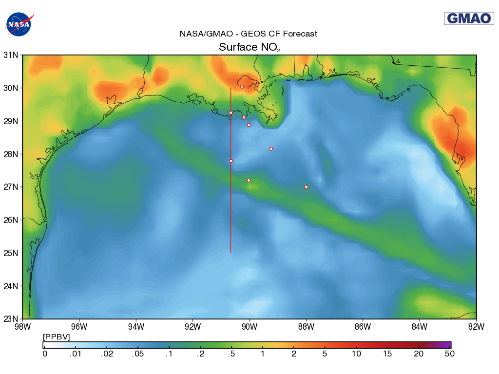
The GEOS Composition Forecast (CF) system produced this forecast of surface nitrogen dioxide (NO2) over the Gulf of Mexico. The dots represent field observation locations, including several ocean oil platforms.
Using 3,416 cores on Discover, 25-km GEOS CF forecasts are produced once a day at 12Z. The forecasts go out 5 days. Forecast runtime is nearly 11 hours. As with GEOS FP, products are provided automatically with each updated forecast.
GEOS CF generates ~350 gigabytes (GB) per day of user products, stored on Discover online disk and exported to the DataPortal. About 440 GB per day get saved in storage.
Scientists on both field campaigns were enthusiastic about these unique forecast products. “The Aeolus team especially appreciated the dust, total precipitable water, wind, and high cloud products, as well as the mobile interface,” said Christine Bloecker, GMAO scientific programmer. “The SCOAPE team gave accolades for the FLUID support as well, remarking that the forecasts were helpful for ‘daily sampling planning, SCOAPE data interpretation, and looking ahead to what photochemical environments we may encounter.’ They also said that the forecasts were almost exactly on point with the photochemical observations, showing the skill of the FP and CF forecasts.”
The GMAO Operational, FLUID, and GEOS CF teams, with the support of key NCCS staff members, all played crucial parts in producing the utilities and data that ensured successful support for the two campaigns and beyond. “While we program the imagery and display site for these campaigns, none of our work would be possible without the resources and computational power provided by NCCS in running these forecasts,” Bloecker added. “The GMAO values our partnership with NCCS in making these missions a success.”
Summer 2019 will be an even busier season, with the GMAO and NCCS supporting field campaigns for the Cloud-Aerosol-Rain Observatory (CAROb), the Arctic - Boreal Vulnerability Experiment (ABoVE), the Fire Influence on Regional to Global Environments Experiment - Air Quality (FIREX-AQ), and the Cloud, Aerosol, and Monsoon Processes Philippines Experiment (CAMP2Ex).
Jarrett Cohen, NASA Goddard Space Flight Center