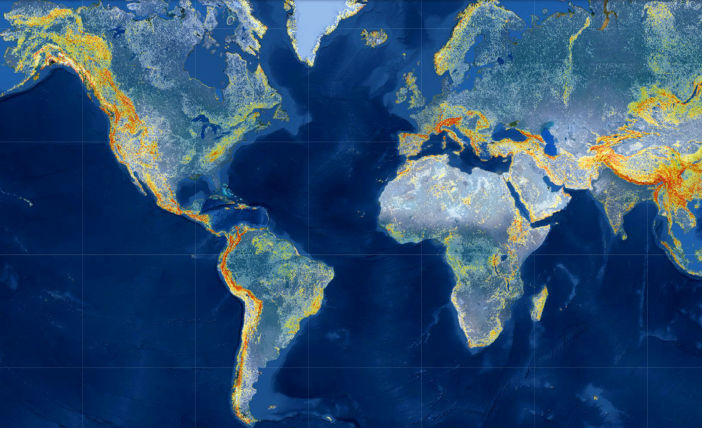
Machine Learning Model Doubles Accuracy of Global Landslide ‘Nowcasts’
What if we could identify at-risk areas anywhere in the world at any time? Enter NASA’s Global Landslide Hazard Assessment (LHASA) model and mapping tool — hosted by the NASA Center for Climate Simulation (NCCS).