Tree Identification in the Sahel using NDVI Thresholding
August Morin
Abstract
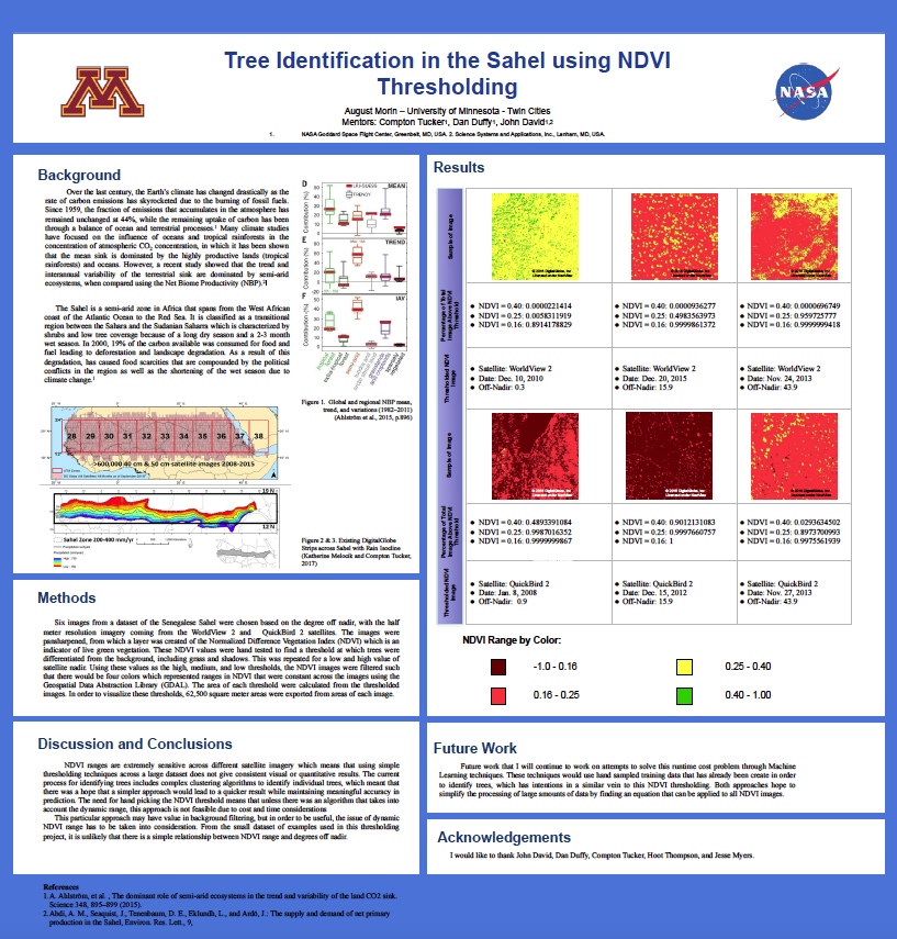
Over the last century, the Earth’s climate has changed drastically as the rate of carbon emissions has skyrocketed due to the burning of fossil fuels. Since 1959, the fraction of emissions that accumulates in the atmosphere has remained unchanged at 44%, while the remaining uptake of carbon has been through a balance of ocean and terrestrial processes.1 Many climate studies have focused on the influence of oceans and tropical rainforests in the concentration of atmospheric CO2 concentration, in which it has been shown that the mean sink is dominated by the highly productive lands (tropical rainforests) and oceans. However, a recent study showed that the trend and interannual variability of the terrestrial sink are dominated by semi-arid ecosystems, when compared using the Net Biome Productivity (NBP).2
The Sahel is a semi-arid zone in Africa that spans from the West African coast of the Atlantic Ocean to the Red Sea. It is classified as a transitional region between the Sahara and the Sudanian Saharra which is characterized by shrubs and low tree coverage because of a long dry season and a 2-3 month wet season. In 2000, 19% of the carbon available was consumed for food and fuel leading to deforestation and landscape degradation. As a result of this degradation, has caused food scarcities that are compounded by the political conflicts in the region as well as the shortening of the wet season due to climate change.1